Getting Lost in the Yosemite Wilderness
A Cheery Start
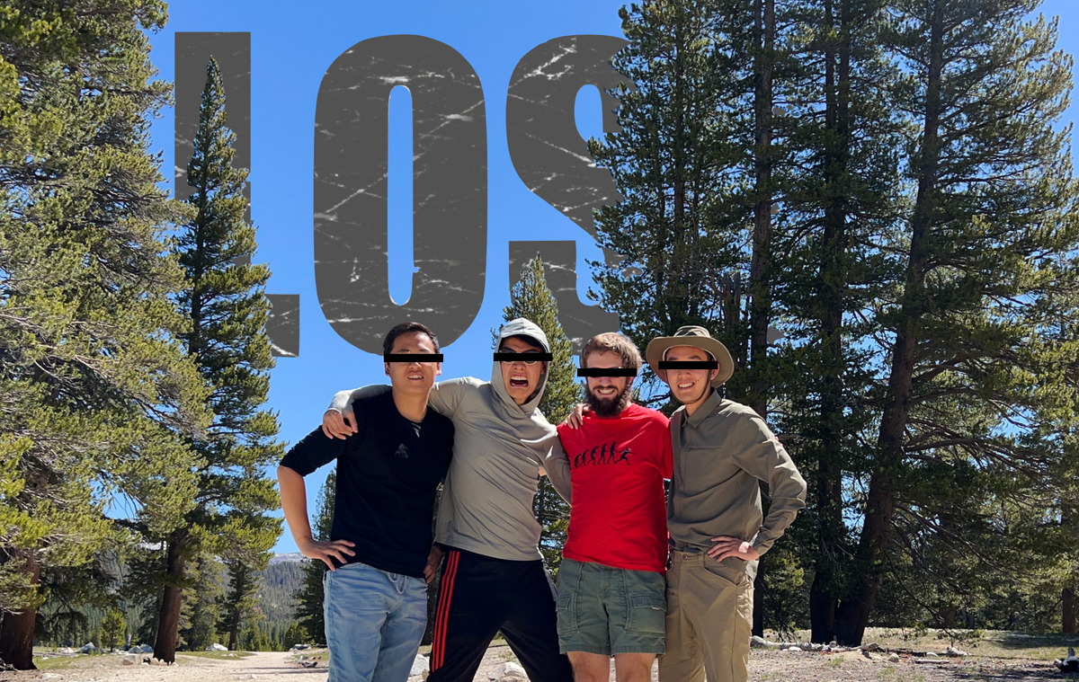
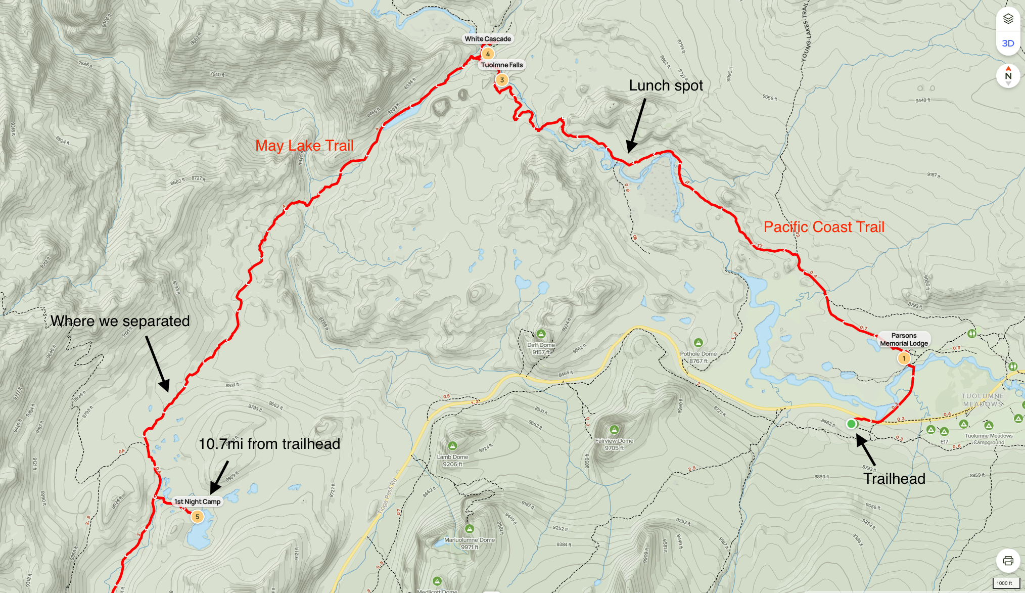
Our team of four started our four day backpacking trip at the Glenn Aulin trailhead in Tuolumne Meadows. The streams were flowing and vegetation was lush after the spring snowmelt, making June an excellent time to hike Yosemite. We would be traversing 46 miles and scaling 4600ft of mountains from Tuolumne Meadows to the Yosemite Valley. Our first landmark was the Parsons Memorial Lodge. There, we were greeted by the first creature we saw in Yosemite: a Marmot chilling on a rock.

We continued down the Pacific Crest Trail (PCT) for 3 miles and stopped at a river bank for our first lunch. Lunch was salami and pickle sandwiches prepared by Brian. The PCT at this section is beautiful because most of the trail follows a meandering river through a pine forest. Huge granite formations formed a backdrop to the forest. The trail had little elevation change and was shaded by tree cover, which made the first part of the journey easy. Stomaches full and energized by the nature around us, our team was in a cheery mood to continue the trek.
Tuolumne Falls was our next major landmark. The snowmelt in May supplied the river with abundant water which thundered down the granite rock cliffs. We clambered down the rocks to restock on water and took some cool pictures in front of the falls. Shortly afterwards, we stopped by White Cascade for another break and photo op. We saw people from the nearby High Sierra camp posing for instagram photos on the other side of the embankment. This was our last stop for the day close to campers as we headed into backpacking territory.
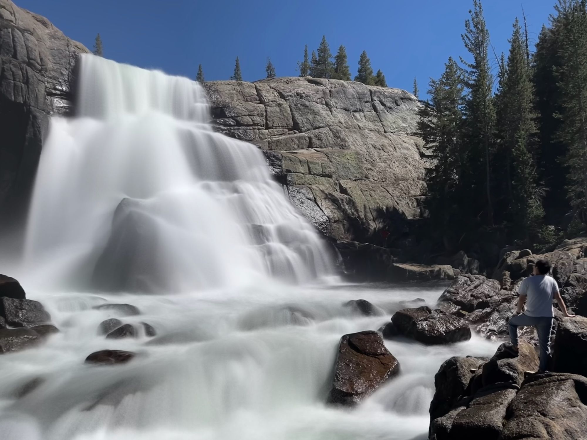
By this point, we were 6 miles in and everybody was moderately tired. However we had 4 miles left to go, so after a short break we headed south-west down Glen Aulin May Lake Trail.
The Sun is Going Down
May Lake Trail is where we first encountered "real" wilderness - this trail was not well maintained and the snowmelt had created muddy patches on the trail. We also encountered mosquitos for the first time. Lots and lots of mosquitos. This part of the route had lots of creeks and still water. The mood of the group took a bit of a hit: with mosquitos and six hours of hiking, we were all starting to feel the weight of our gear. Nonetheless we kept marching on.
About 2mi from the first night's campsite, Brian was struggling to keep pace. The sun was closing in on the mountain ridge - we didn't want to setup camp in the darkness. Since Kevin and Brian were sharing a tent, they stayed back while Wenchao and I sped up. This turned out to be my first mistake of the night.
This would be a good time to mention that only I had the trail map and satellite communicator. We also did not have any walkie talkies to communicate to each other. There were more forks on the trail than it had looked on the map, so I began to worry that Brian and Kevin may not be able to find us if we ventured too far. Around this time, Wenchao and I encountered by a couple that had setup camp for the night. We chatted for a bit - they had not been able to reach the campsite before dusk so they decided to setup camp at a flat near the trail. I thought this would be a good landmark, so I told Wenchao to wait there for Brian and Kevin to catch up. This turned out to be my second mistake.
Accumulation of Mistakes
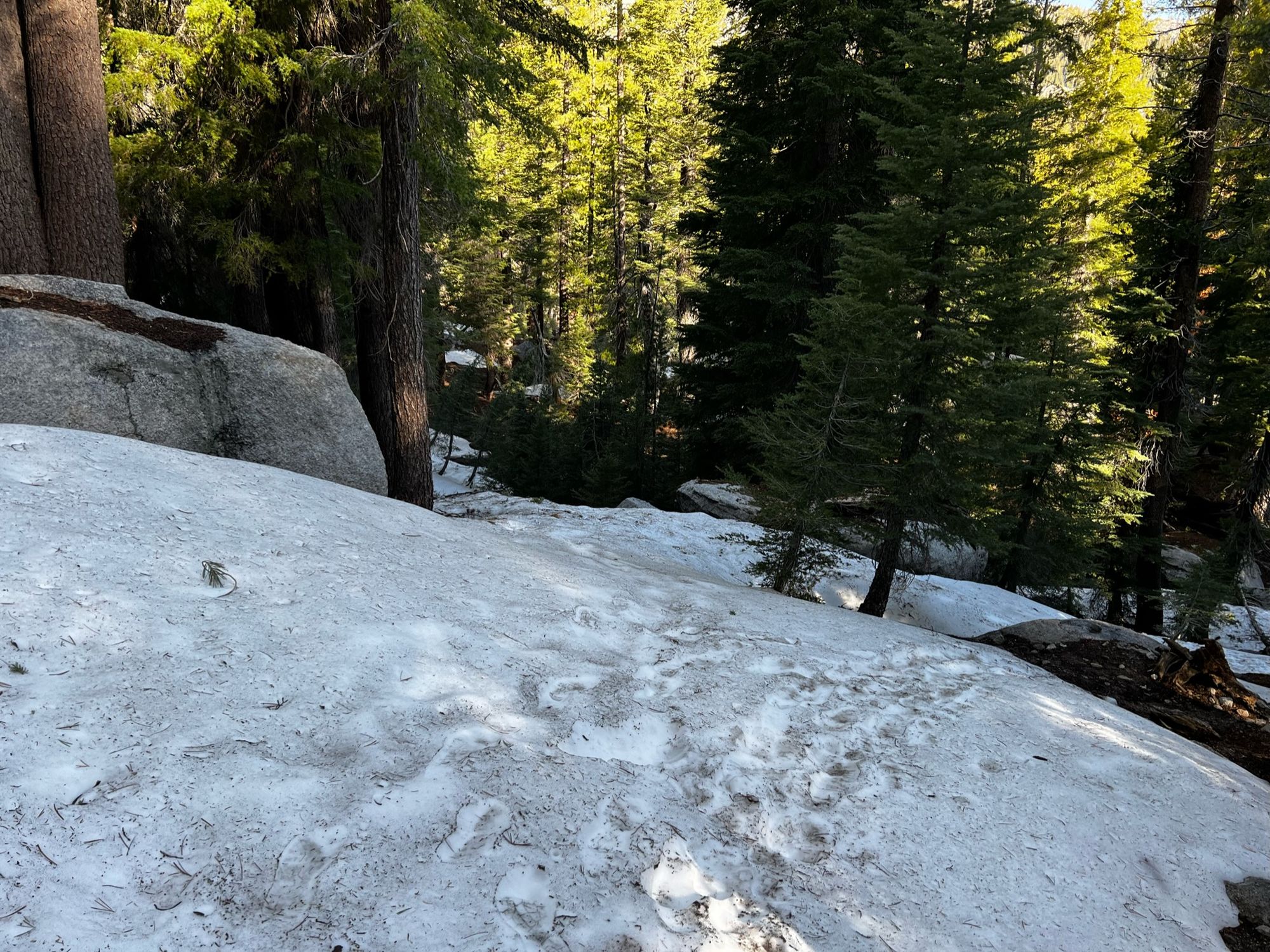
As I approached Polly Dome Lakes, I saw that reaching the lakes required traversing a snow capped hill. I was not sure if this hill could be traversed in our gear, or how long the snow extended. By this point, I was at a valley floor and the granite formations had given way to dense forest. Since there weren't any particularly good camping spots around the area, I decided to backtrack back to the couple. When I reached the couple, to my surprise Wenchao was gone. I asked the couple if they had seen anybody walk by, and they said they had seen two. I specifically asked if it was one Asian and one Caucasian guy, which they confirmed. I asked them if they saw another Asian guy, and they said no. This is when my heart sank.
The sun was disappearing over the mountains and the eery silence of dusk was setting in. So far, I knew that Kevin and Brian were somewhere ahead of me. However, I knew that they had not taken the correct trail because I had just walked back from it. Furthermore, Wenchao could be separated. Brian and Kevin could survive the night as they had a tent between them. However Wenchao did not have a tent because I was carrying it. I set my backpack down near the couple and asked them to watch it. I trekked to an off-trail I thought they may have taken to try to find either Kevin and Brian or Wenchao. After about a half mile in and calling out their names with no response, I was straying too far from the correct trail, so I backtracked to the couple again. The couple still had not seen anybody from my group.
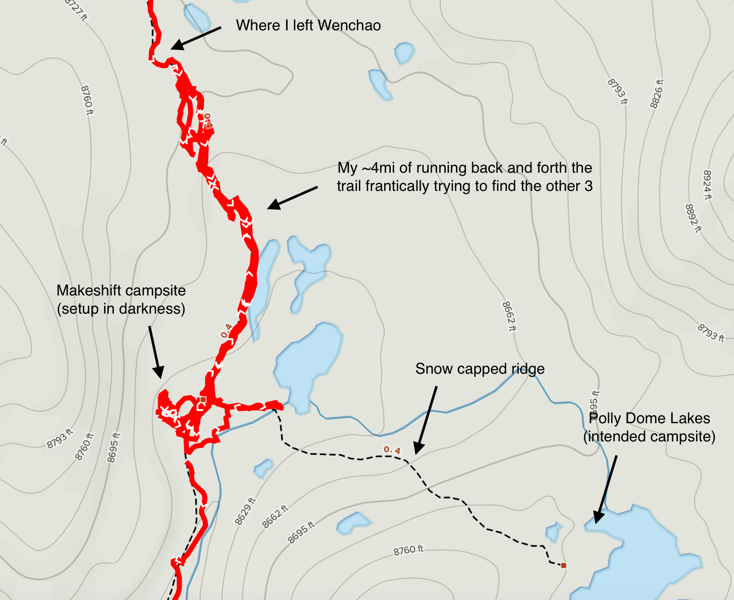
At this point I was starting to feel distressed as the sun had almost fully set. I ran down the trail until I got to where I had originally turned back. I blew my whistle and listened: silence. I walked some more, blew my whistle and listened: silence. I stood still, thinking about where the group may have gone, hearing my heartbeat in my ears, and thinking about what to do next. Then I heard a faint sound in the distance. And again - it was a whistle. I blew my emergency whistle and yelled out "HELLO?". After a few seconds, I heard a reply. I rushed towards where I thought the sound was coming from - the direction of the snow capped hill. After a few minutes, I saw Kevin, then Brian emerge from the other side of the snow capped hill but did not see Wenchao. I ran over and shouted at Kevin, "where the hell is Wenchao?" Kevin replied he's here and I sighed relief as Wenchao emerged from the hill as well. We had united at last, in near darkness.
Wenchao had been waiting just out of the couple's site down the trail. Therefore the couple only saw Brian and Kevin when they passed by. Wenchao had a lower resolution offline Google map downloaded which he had used to navigate the three of them to Polly Dome Lakes using a different path than what I had on my All Trails map.
Our headlights illuminated the otherwise dark night as we setup our first night's camp. Dinner was prepared and eaten solemnly in the dead of the night. We were physically and mentally exhausted. One by one we made our way into our tents and crawled into our sleeping bags to take refuge from the cold. Despite the exhaustion, I lay awake to a mixture of emotions as my head tried to make sense of the beauty, awe, and unforgivingness of nature we had experienced that day. Relief mixed with thoughts of "what would I have done if we had not found each other" blurred together as I slowly drifted off into slumber.
Lesson Learned
There is an easy solution to not splitting up and getting lost. Here is the solution: do not split up. And we did not split up for the remainder of the trip.
"The best way to correct a mistake is to make it right" - Henry David Thoreau
These are the three must do's for not getting lost during backpacking:
- Stick together as a group. Don't lose site of your group: wait for the slowest person to catch up.
- Download a GPS map like All Trails and carry a power bank with enough juice for the entire trip. I use a 20,100 mAh power bank and keep my phone on low power mode to last 4 days.
- Carry a satellite communicator with an emergency SOS function. I used a Zoleo for this trip and replaced it with an InReach Mini 2 for subsequent trips.
If you choose to split up (as a conscious decision):
- Carry walkie talkies or radios to keep communication between groups.
- Each group should follow steps 2 and 3 from the previous list.
- Align on a preset meeting point.
I hope by reading this post you are able to learn from my mistakes and enjoy a safe backpacking experience.